
WidgetCharts
3D Earth
3D Earth
Data Configuration
| Map Type | Data Query Type | Mapping Method |
|---|---|---|
| 3D Earth | Aggregated Data | Major country names, major city names globally |
Geographic location data should be in Chinese place names.
- Can be countries, e.g., China, United States;
- Can also be major global cities: London, New York, Beijing, etc.
Display Formats
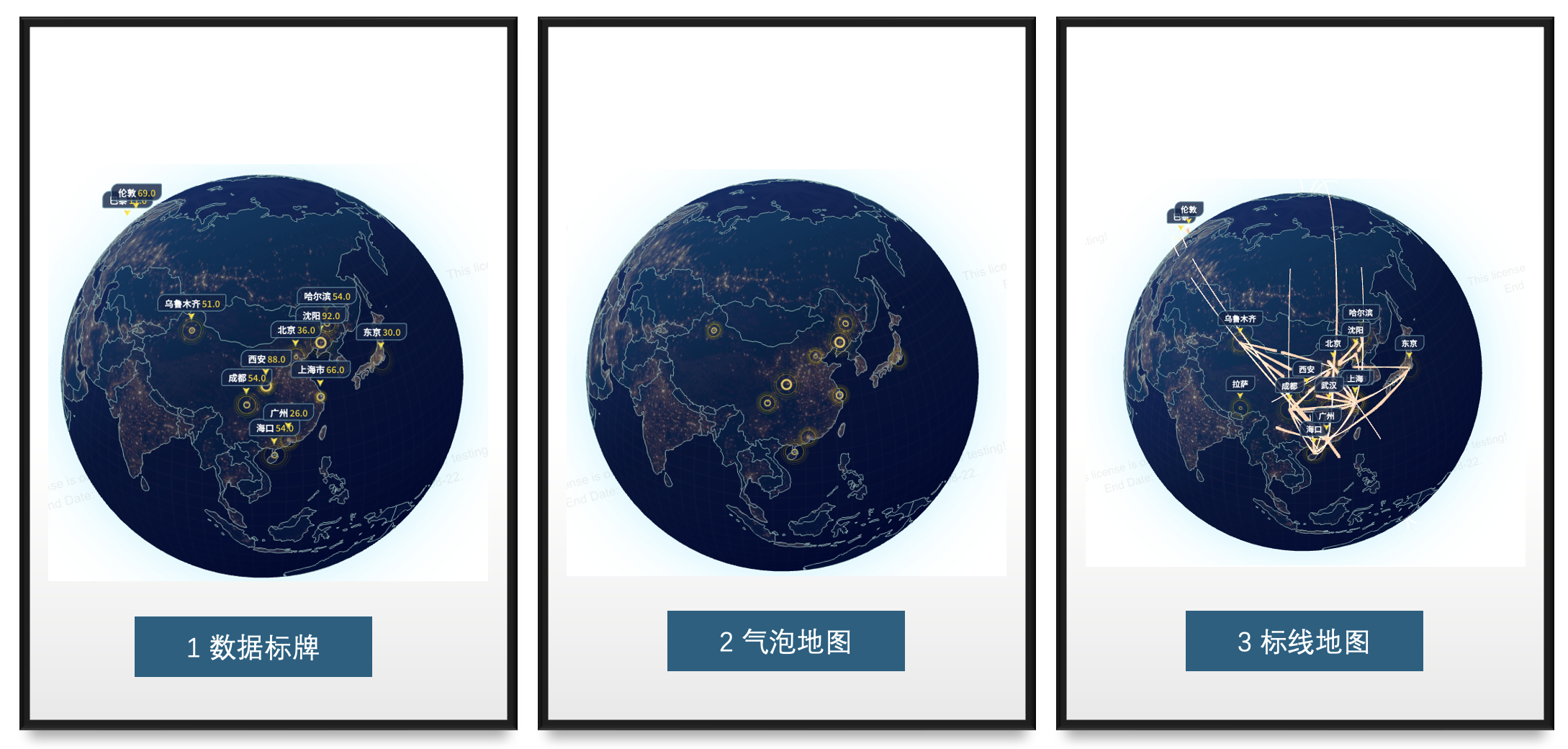
- Region Markers: Uses the first field of the row dimension as the map location data.
- Bubbles: Uses the first field of the row dimension as the map location data.
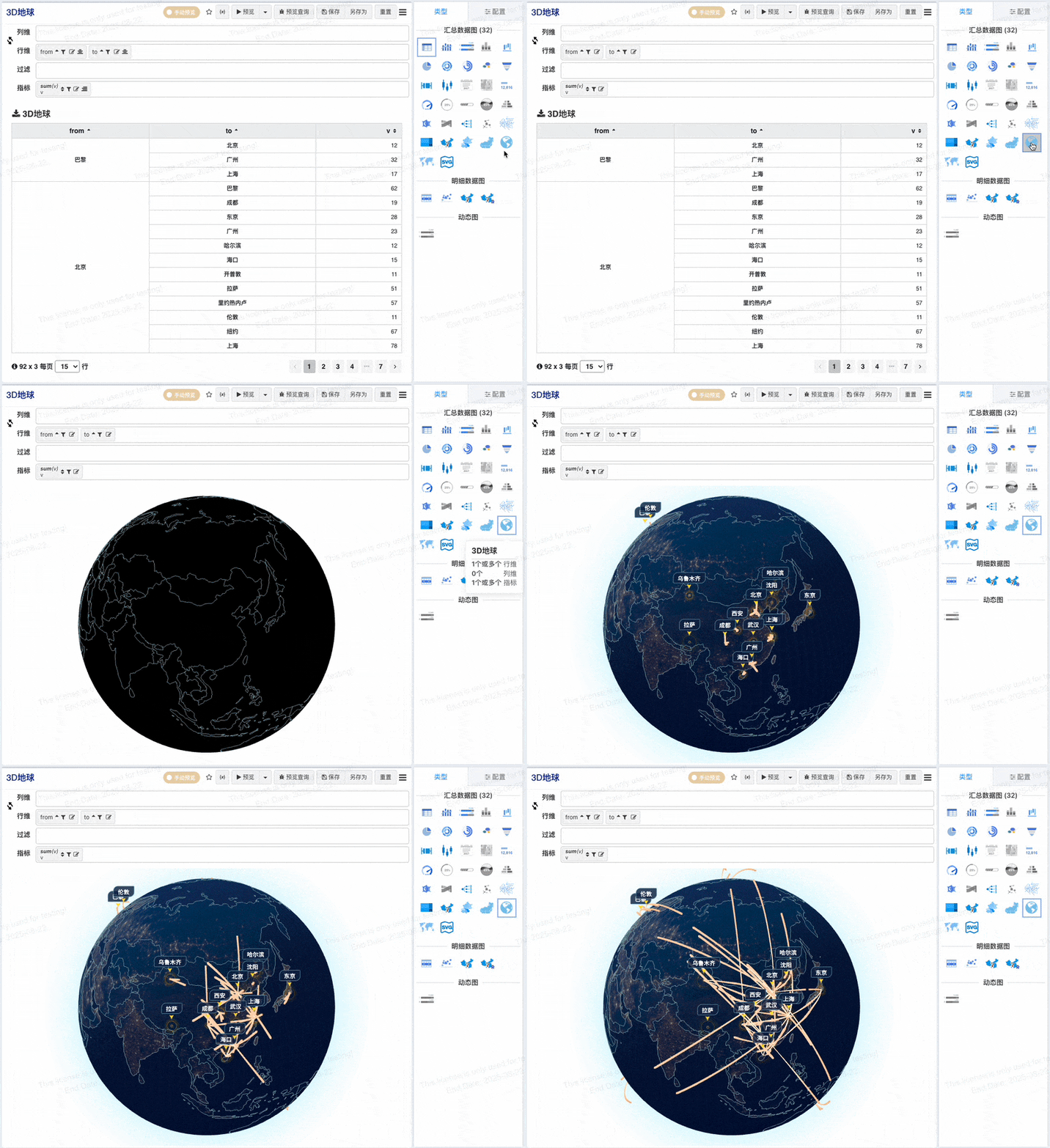
- Flow Map: Uses the first row dimension as the starting location and the second row dimension as the ending location.
From a cross table to a 3D Earth, just one simple step.
Data can be displayed in various formats, including data markers, data bubbles, and flow lines, making information representation more intuitive and vivid.
Additionally, it supports automatic globe rotation and the function to focus on China, providing a more immersive and targeted geographical data presentation.