Latitude-Longitude Map (Baidu Online)
Latitude-Longitude Map (Baidu Online)
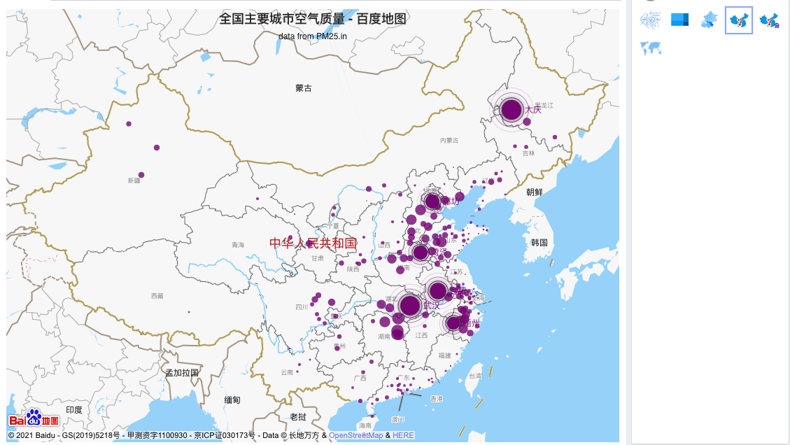
This map calls the Baidu online map. Its data requirements are the same as the local China map above, requiring an internet connection to request the Baidu Map API and rendering based on detail data (you need to apply for a Baidu Developer AK yourself).
Process to obtain a Baidu Map development key: Click here Note: Commercial use of the Baidu Map developer key requires payment to Baidu Company for permission.
Setting the Developer Key
Add Baidu Map developer calls through extended configuration.
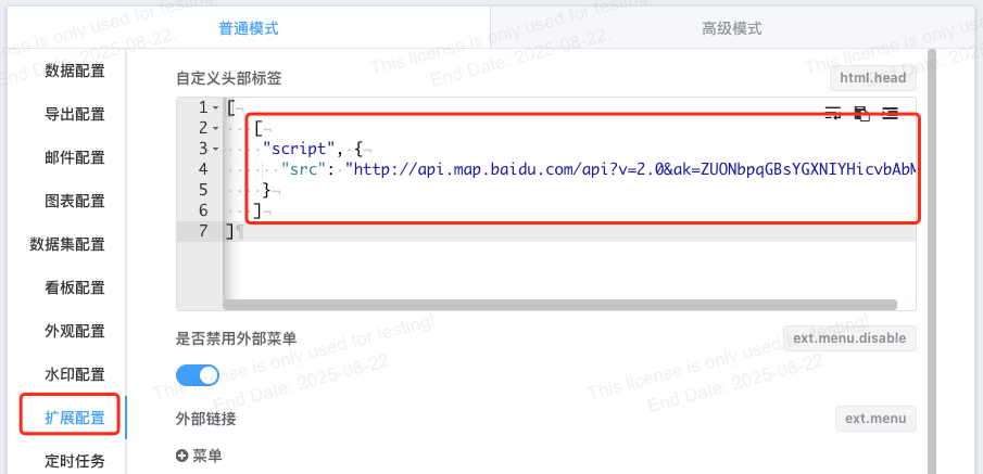
[
   [
    "script", {
      "src": "http://api.map.baidu.com/api?v=2.0&ak=xxxx"
    }
   ]
    // ... Other configuration items
]
Data Configuration
Data configuration is completely consistent with the local latitude and longitude map, including latitude and longitude mapping and detail data.
Data Types
| Data Type | Explanation | Configuration |
|---|---|---|
| Name | Administrative region name, e.g., Shanghai | Scatter/Bubble Chart: Place in row dimensions as [Geographic Name] + [Additional Info] Flow Line: Place in row dimensions as [Origin Name] + [Destination Name] + [Additional Info] 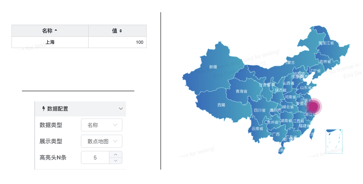 |
| Separate Latitude/Longitude | Separate latitude and longitude, e.g., Longitude: 121.47 Latitude: 31.23 | Scatter/Bubble Chart: Place in row dimensions as [Longitude] + [Latitude] + [Additional Info] Flow Line: Place in row dimensions as [Origin Longitude] + [Origin Latitude] + [Destination Longitude] + [Destination Latitude] + [Additional Info] 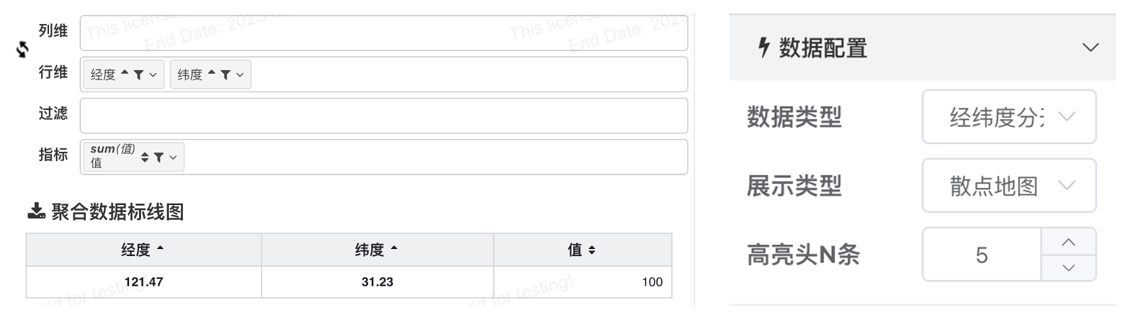 |
| Combined Latitude/Longitude | Combined latitude and longitude: 121.47,31.23 | Scatter/Bubble Chart: Place in row dimensions as [Longitude,Latitude] + [Additional Info] Flow Line: Place in row dimensions as [Origin Longitude,Origin Latitude] + [Destination Longitude,Destination Latitude] + [Additional Info] 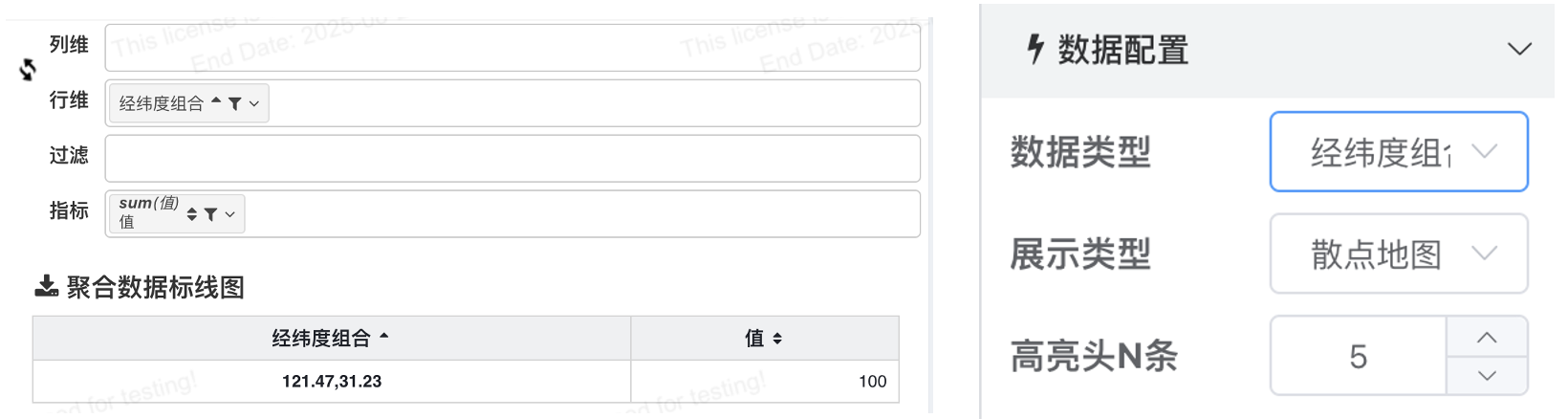 |
Why can a name be used for latitude/longitude mapping?
Q: For latitude/longitude mapping, there is a Name option in the data configuration?
A: We have a built-in dictionary of Chinese city latitude and longitude coordinates for convenience when only city names are available. Using city names for data mapping requires manual aggregation of the data.
Display Type
After selecting the data type, configure the data according to the configuration requirements.
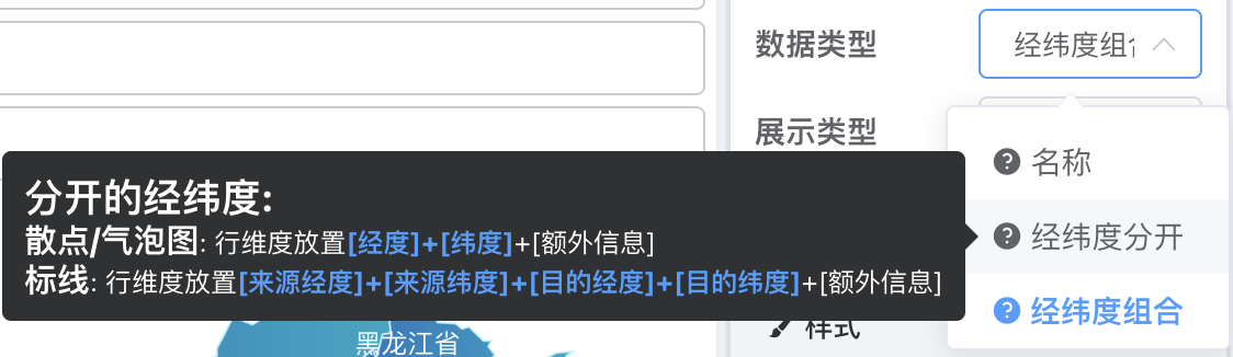
For example, if the data type selected is Name and the display type selected is Flow Line, then the dimension configuration needs row dimensions configured as [Origin Name] + [Destination Name].

Using BMap Advanced Development
BMap provides developers with many powerful layer style control APIs. Baidu Map Open Platform JavaScript API v3.0
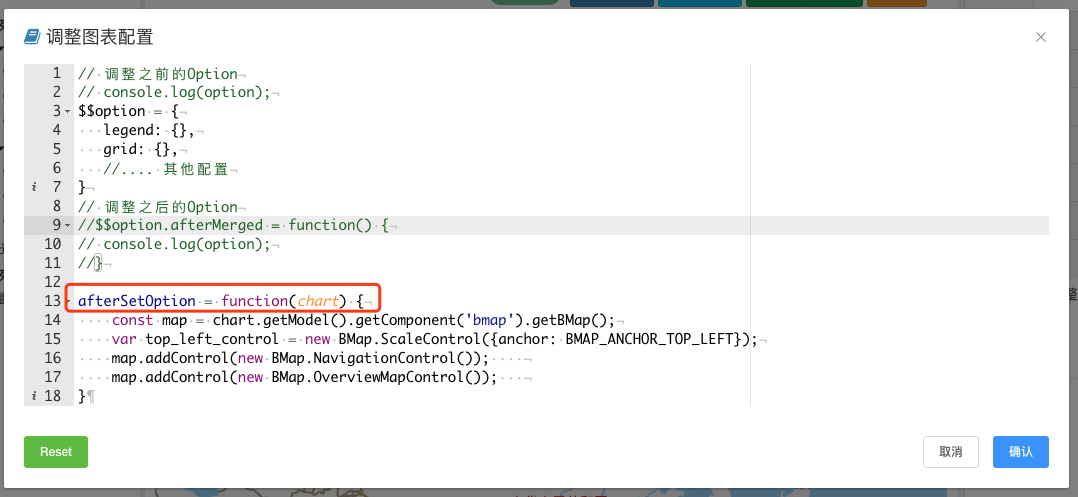
On the IBI platform, users can control these through developer mode within the afterSetOption function.
afterSetOption = function(chart) {
    const map = chart.getModel().getComponent('bmap').getBMap();
    var top_left_control = new BMap.ScaleControl({anchor: BMAP_ANCHOR_TOP_LEFT});
    map.addControl(new BMap.NavigationControl());
    map.addControl(new BMap.OverviewMapControl());
}