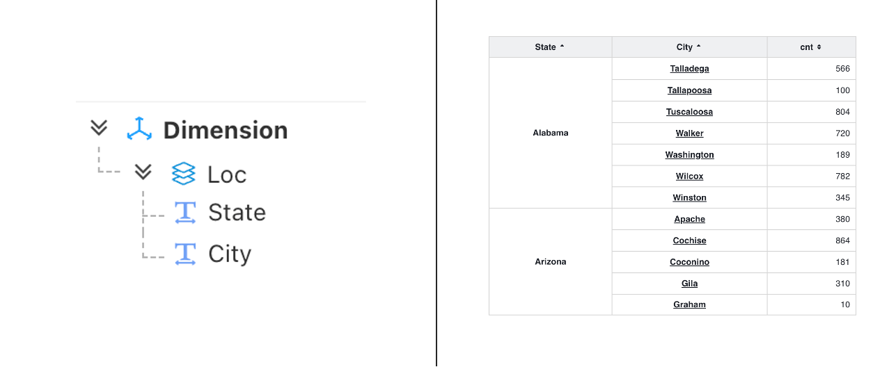
Area Map
Area Map
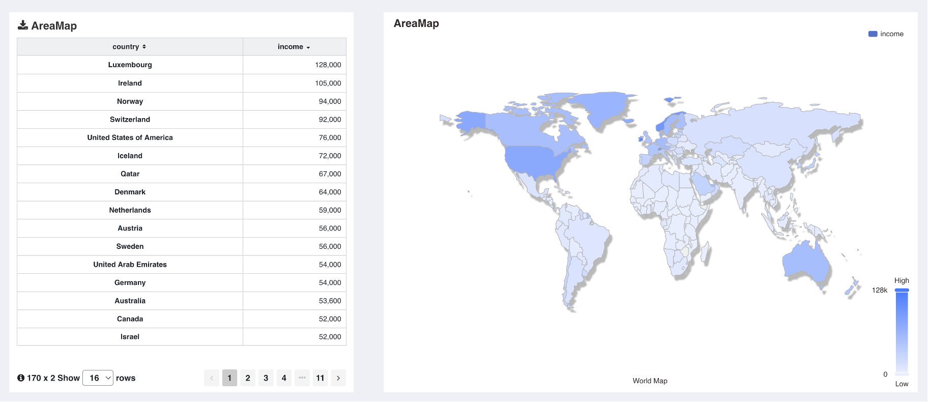
As the name suggests, a Area Map maps geographical areas. On a one-dimensional coordinate system based on region names, if a data name provided by the user matches a block name on the map, the corresponding region is highlighted (Visual Mapping).
| Map Type | Data Query Type | Mapping Method |
|---|---|---|
| Area Map | Aggregated Data | Region Name |
The image below shows the default World Country Map.
Region Selection
Region selection allows you to choose the map's geographical areas. Once a region is selected, for data to be correctly mapped onto the map, corresponding regional data must be provided.

Map Level
Selecting Map Level
After selecting the map data, users can uncheck Region Auto-Adapt and choose a fixed administrative level.
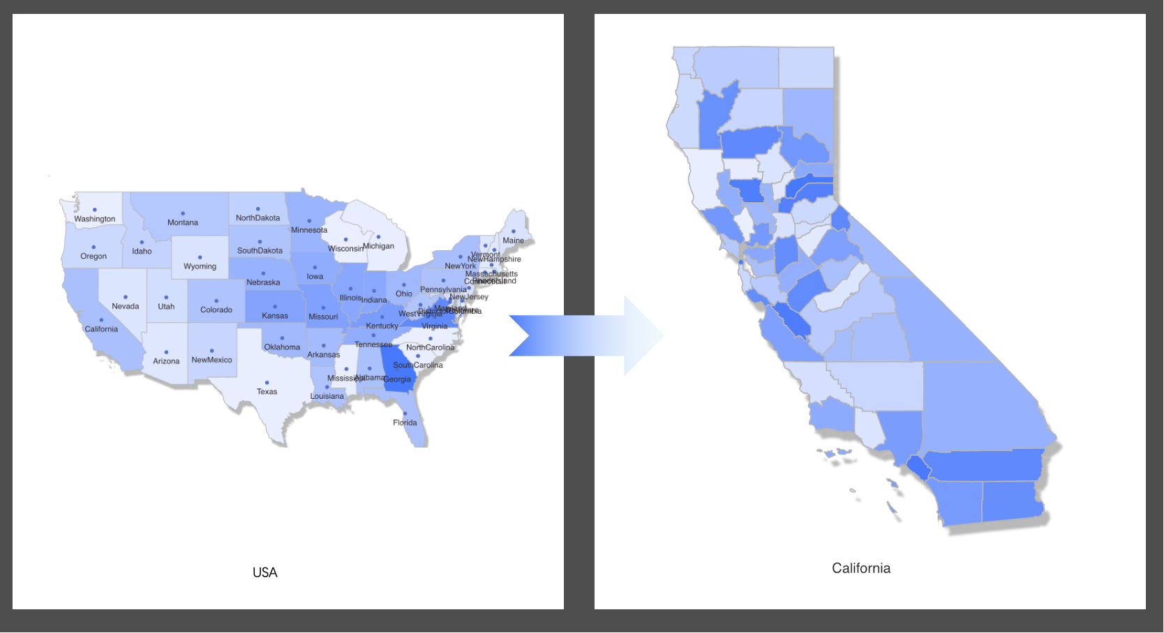
Region Drill-Down
Region auto-adapt is used for map drill-down. It requires having hierarchical dimensions corresponding to the map's administrative levels. After enabling region auto-adapt, clicking on a region for drill-down will limit the data to the clicked area, and the map layer will automatically change based on that region.